| City, town or village | County | State | Country | Elevation |
| Warroad | Roseau County | Minnesota | USA | 1066 feet (325 meters) |
| Latitude (DMS format) | Longitude (DMS format) | Map on which this town can be found |
| 48° 54' 26"N | 95° 19' 02"W | Warroad |
Warroad is located in northwest Minnesota,
south of the Canadian border in northeastern
Roseau County. It sits on the southwest
corner of Lake of the Woods, which is billed
as the "Walleye Capital of the World."
Over the years, Christian Brothers (a premier
manufacturer of hockey sticks) and particularly,
Marvin Windows and Doors, have played an integral
role in the development and improvement of life
in Warroad and the surrounding area. As the
largest made-to-order manufacturer of wood
windows and doors in the world, Marvin Windows
and Doors is the single largest employer in
Warroad and one of the largest in all of
northern Minnesota.
Christian Brothers later became Christian Hockey
Sticks and moved their operations to the nearby
town of Roseau.
As the original "Hockeytown USA" Warroad has
produced a number of Olympic and NHL hockey
players, including Hockey Hall of Famer and
Olympic silver medalist Henry Boucha.
Origin of its unusual name
Warroad received its name from the practice of
Native American tribes frequently traveling
through the area to wage war against one another.
One of the largest Chippewa Indian villages in
the region was located on the site the town now
occupies. They fought a protracted and vicious
war with invading Sioux, whose route to the
area ended at the mouth of the Warroad River.
The Sioux, who hailed from the prairies of the
Red River Valley near the Minnesota-North Dakota
border, frequently used this same route to attack
the local Chippewa tribe. This historic "war road"
thus lent its name to both the town and river.
Nearby cities and towns:
Baudette, Minnesota (to the east)
Roseau, Minnesota (to the west)
Thief River Falls, Minnesota (to the southwest)
Fourtown, Minnesota (to the south)
Kelliher, Minnesota (to the southeast)
Time Zone: Warroad, Minnesota is in the Central Time Zone.
Plant Hardiness Zone: 3a
NOTE: Some rural areas to the north and also
southeast of town are in the colder zone 2b.
Visit our page of U.S. plant hardiness zones for
a look at maps showing all hardiness zones throughout
North America.
Over the years, points of interest in the region have included:
* Lake of the Woods, east of Warroad
* Zippel Bay State Park, east of Warroad
* Hayes Lake State Park, southwest of Warroad
* Beltrami Island State Forest, south of Warroad
* Lost River State Forest, north of Roseau
* Clementson Rapids, east of Baudette on Highway 11
* Red Lake Wildlife Management Area, southeast of Warroad
* Minnesota State Wildflower Route, Highway 11 east of Warroad
* Warroad Heritage Center and Museum, Main Avenue NE, Warroad
* Waters of the Dancing Sky Scenic Byway, across northern Minnesota on Hwy. 11
* Agassiz National Wildlife Refuge, southwest of Warroad
(originally named Mud Lake Migratory Waterfowl Refuge)
* Minnesota Pine to Prairie Birding Trail (stretches from
Fergus Falls, Minnesota in the south, and up into Canada in the north)
Recreational opportunities in the area
Camping, boating, fishing, hunting, ice fishing,
trapping, picnicking, swimming, canoeing, mountain
biking, bird watching, photography, wildlife viewing,
golfing, ATV riding, cross-country skiing, snowmobiling
and horseback riding.
Wildlife found in northwestern Minnesota
Bear, beaver, coyote, deer, fisher, fox, marten,
mink, moose, muskrat, otter, raccoon, skunk,
squirrel, weasel, wolf, pelican, crane, goshawk,
eagle, duck, killdeer, osprey, red-winged blackbird,
grouse, loon, and geese.
Anglers will find Lake of the Woods is home to a
variety of fish including Lake Sturgeon, Largemouth
Bass, Smallmouth Bass, Northern Pike, Sauger, Yellow
Perch and Walleye.
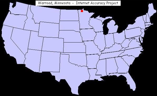
U.S. map showing the location of Warroad, Minnesota
We now provide a lot map for 306 Hallberg Street in Warroad,
Minnesota, to address several inquiries we've received
in regard to the unusual placement of lots there.
For an extensive list of other odd town names in the
United States, visit our page of unusual, bizarre or humorous names of towns.
|