| City, town or village | County | State | Country | Elevation |
| Crook | Logan County | Colorado | USA | 3711 feet (1131 meters) |
| Latitude (DMS format) | Longitude (DMS format) | Map on which this town can be found |
| 40° 51' 32"N | 102° 48' 4"W | Crook |
Crook is located in the northeastern corner
of Logan County, in northeastern Colorado.
Found just a few miles south of the
Colorado-Nebraska border, Crook, Colorado
sits just north of the South Platte River
on U.S. 138.
Origin of its unusual name
Crook, Colorado was named for General George Crook,
a military commander in the region back in the early
1880s when the area was settled.
Nearby towns:
Colton, Nebraska (to the north)
Sidney, Nebraska (to the northwest)
Julesburg, Colorado (to the northeast)
Sterling, Colorado (to the southwest)
Fleming, Colorado (to the south)
Holyoke, Colorado (to the southeast)
Time Zone: Crook, Colorado is in the Mountain Time Zone.
Plant Hardiness Zone: 5a
Visit our page of U.S. plant hardiness zones for
a look at maps showing all hardiness zones throughout
North America.
Over the years, points of interest in the region have included:
* Atwood State Wildlife Area (near Atwood, Colorado)
* Bravo State Wildlife Area (near Sterling, Colorado)
* Duck Creek State Wildlife Area
* Dune Ridge State Wildlife Area (near Sterling, Colorado)
* Frenchman Creek State Wildlife Area (near Holyoke, Colorado)
* Knudson State Wildlife Area (near Sterling, Colorado)
* North Sterling State Park (north of Sterling, Colorado)
* Overland Trail State Wildlife Area (near Atwood, Colorado)
* Pawnee National Grassland (near Greeley, Colorado)
* Red Lion State Wildlife Area
* Sedgwick Bar State Wildlife Area (near Sedgwick, Colorado)
* Summit Springs Battlefield (near Sterling, Colorado)
* Tamarack Ranch State Wildlife Area
* Jumbo Reservoir State Wildlife Area (a.k.a. Julesburg Reservoir)
Recreational opportunities in the area
Camping, boating, fishing, hunting, water skiing,
jet skiing, sailing, golfing, basketball, volleyball,
bowling, hiking, picnicking, swimming, mountain biking,
wildlife viewing, bird watching, cross-country skiing,
snowmobiling, photography, ATV riding and horseback
riding.
A sampling of wildlife found in northeastern Colorado
Deer, antelope, coyote, fox, prairie dog,
rabbit and squirrel. A few of the birds that
spend time in the region include the cardinal,
catbird, crow, dove, duck, eagle, goose,
grouse, hawk, lark, magpie, oriole, owl,
pheasant, plover, quail, robin, sandpiper,
sparrow, turkey, warbler, woodpecker and wren.
While Pawnee National Grassland located west of
Crook, Colorado is recognized as a world-class
birding location, the sparsely populated nearby
South Platte River area is known for its pheasant,
quail, dove, and waterfowl hunting. Excellent
birding opportunities also exist locally throughout
Logan County at several State Wildlife Areas
listed above.
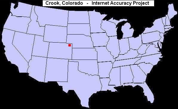
U.S. map showing the location of Crook, Colorado
For an extensive list of other odd town names in the
United States, visit our page of unusual, bizarre or humorous names of towns.
|